Vintage Wall Map of India, Pakistan, Ceylon and Burma in 1950
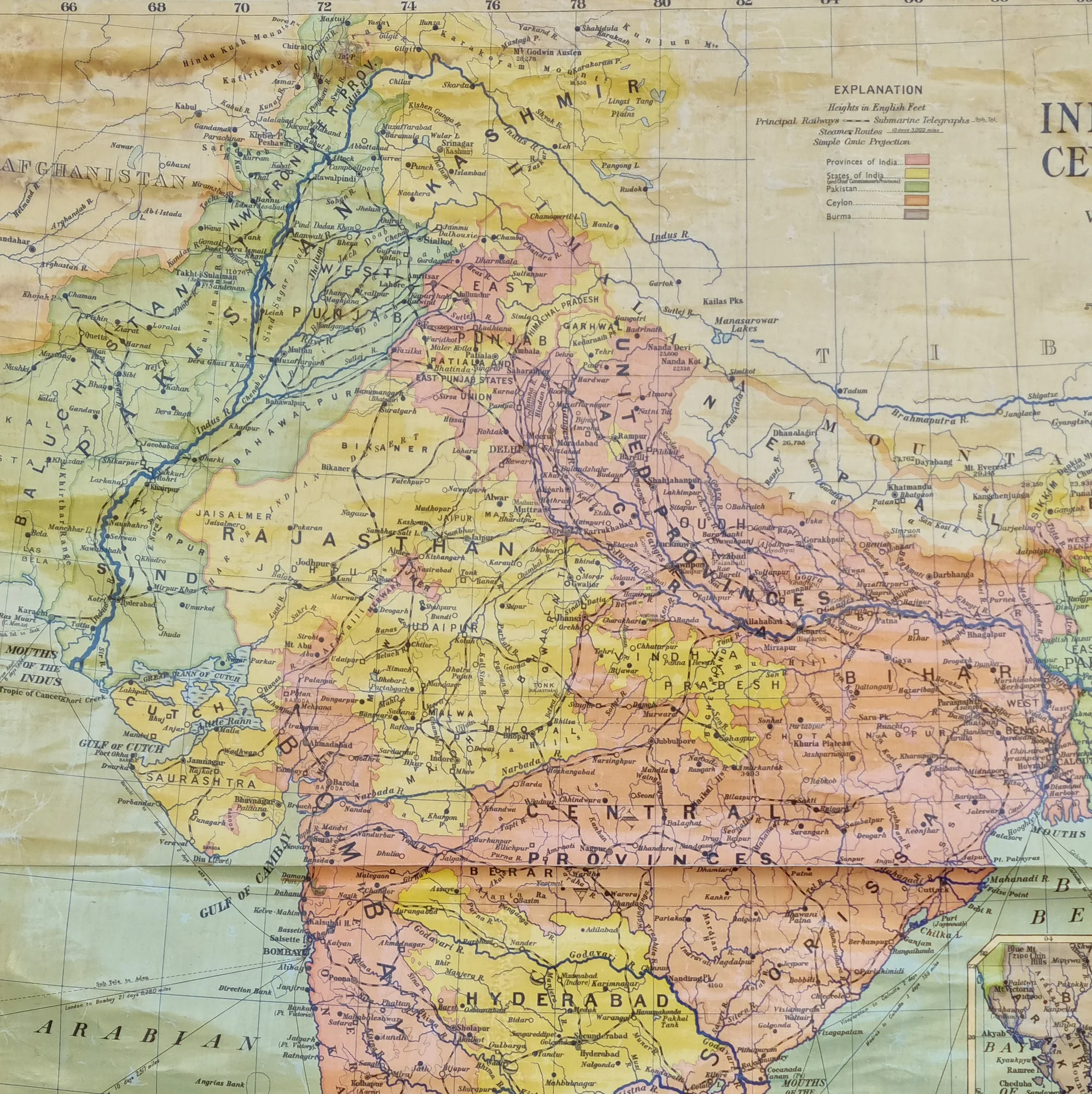
Vintage Wall Map of India dated 1950 was printed by W and A.K. Johnson in Edinburgh. The coated canvas map shows India, Pakistan, East Pakistan, Ceylon and Burma. It has a lovely aged-patina that only old maps and documents acquire.
It shows fading, a crease along the centre and discolouration.
Size: W109cm x H130cm
Product Information
Product Information
Shipping & Returns
Shipping & Returns


Vintage Wall Map of India, Pakistan, Ceylon and Burma in 1950
Vintage Wall Map of India, Pakistan, Ceylon and Burma in 1950
Vintage Wall Map of India dated 1950 was printed by W and A.K. Johnson in Edinburgh. The coated canvas map shows India, Pakistan, East Pakistan, Ceylon and Burma. It has a lovely aged-patina that only old maps and documents acquire.
It shows fading, a crease along the centre and discolouration.
Size: W109cm x H130cm
Product Information
Product Information
Shipping & Returns
Shipping & Returns
Description
Vintage Wall Map of India dated 1950 was printed by W and A.K. Johnson in Edinburgh. The coated canvas map shows India, Pakistan, East Pakistan, Ceylon and Burma. It has a lovely aged-patina that only old maps and documents acquire.
It shows fading, a crease along the centre and discolouration.
Size: W109cm x H130cm